Up early today and weighed anchor at 5:55AM under a nearly full moon. We’re off to the Bowen Channel, aiming to enter at Point David just after high tide to maximise depth and have the ebb current with us. Destination is Raffles Bay for a day of administrative taks while we (hopefully) have Internet from Croker Island.
We motored most of the way, with a light SE wind behind us and an optimistically hoisted main sail giving us a little push while damping the little roll.
We’re welcomed by two old dolphins with fairly worn-out looking dorsal fins. They kept pace for almost the whole length of the Strait. We speculated whether they were herding us away from the shoals and reefs as they were now this side then the other. Sometimes at the bow and then coming up from astern. We were not upset to be part of this old-timers club!

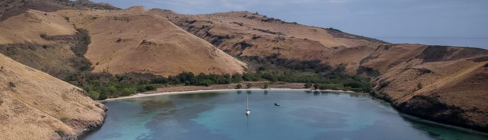
We are now anchored in Raffles Bay, behind Second Island. It’s a lovely anchorage and we managed to get close to the sandy beaches which we might explore a little later.
Yotties info: We got to the southern entrance of Bowen Strait around 7:30am, 15 minutes after high tide, but the current was still running east at about a knot. In fact, it was 9:30am before it turned in our favour, a full 2 hours after high tide at Point David and almost 3 hours after high tide at Peacock Island at the northern end of Croker Island.
We found Bowen Strait has good depth throughout on the track shown. As others have found, the chart bathymetry is pretty hopeless. The shallowest point was at the south-east entrance, not unlike a river bar, where we found about 5m LWS. In other places, where Navionics HD bathymetry showed 0.5m, we got 12-15m. A pity as we may have sailed rather than motored if we were confident about the depths. We referred to Google Earth for guidance as the water colour along the shores at least seems to show shoal water and reefs.
The anchorage behind second island was perfect for our conditions, with 3m depth (LWS) over sand. We used Google Earth to creep in and found an evenly sloping sandy bay with no reefs. There is no NE swell to speak of and it appears well protected from SE winds. Bonus: 2 bars of fast 4G Telstra Internet!

You must be logged in to post a comment.